Illustrated map of USA in French, World War II
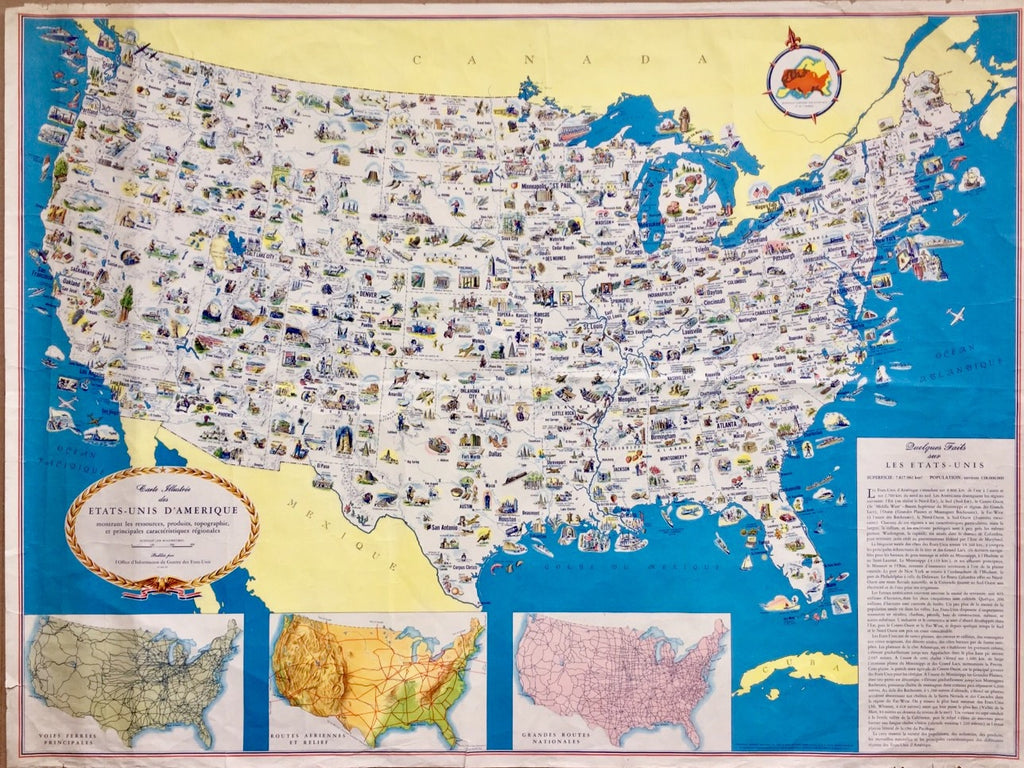


A FASCINATING, original, richly illustrated map of the United States in French, created by General Drafting in New York some time between 1942 and 1945 for distribution by the U.S Office of War Information.
Size
81cm x 61cm
Condition
The map is in good condition, with minor wear on the margins and some discolouration on the far left. If you would like to know more please get in touch.
Background
The title says the map shows the 'resources, products, topography and principal regional characteristics' of the USA. Inset are maps of the main US rail, air and road routes and a box giving geographical and economic facts. General Drafting was a leading US map-maker. The Office of War Information existed from 1942 to September 1945. The purpose of the map is not clear.